Camp Chase Trail - Wilson Road East to trail's end at Alkire Road
(This description of the 2011 trail construction on the Camp Chase Trail
is courtesy of Tom Recktenwalt - Miami Valley Rail Trails webmaster)
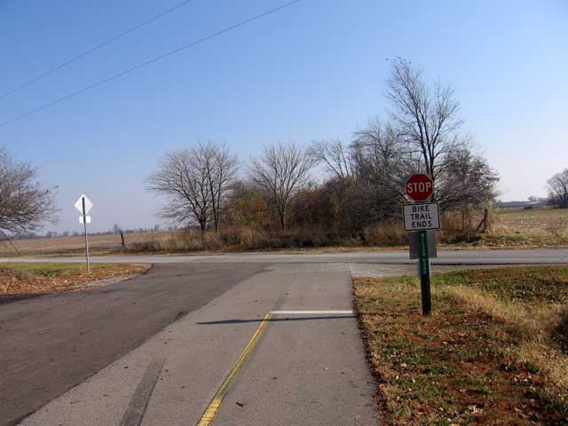
This first picture shows the end of trail at Wilson Road. We are looking East from the
Trailhead at Wilson Road across the road to the un-built section. Land acquisition issues
have been resolved and that section of trail is being designed. (Photo: Richard Gehman)
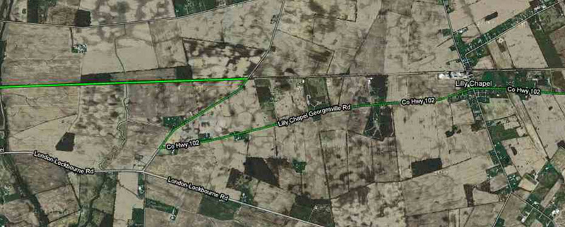
In the meantime, here is a Google Map to show you a road route South from Wilson Road and East on Lilly
Chapel-Georgesville Road that will get you back to the trail at Lilly Chapel. The trail is in green and stops at
Wilson Road. Your detour is Wilson Road Southwest to Lily Chapel-Georgesville Road (Hwy 102) then East
on Hwy102 to Lily Chapel and the start of the trail. This detour is 3.7 miles. (It would be about 1.6 miles from
Wilson Road to Lily Chapel along the trail.)
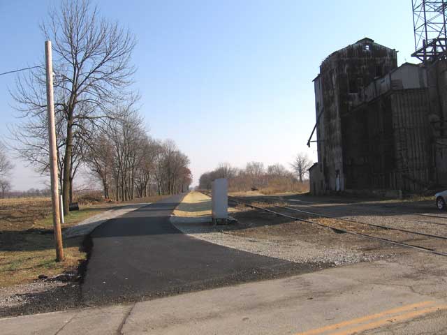
The town of Lilly Chapel is 1.64 miles from Wilson Road. There is a large grain elevator at
the crossing of W. Jefferson Kiousville Road and the trail. Here we are looking from the
crossing of the road with the trail East along the new trail. You can see part of the large
grain elevator to the right of the photo. (Photo: Richard Gehman)
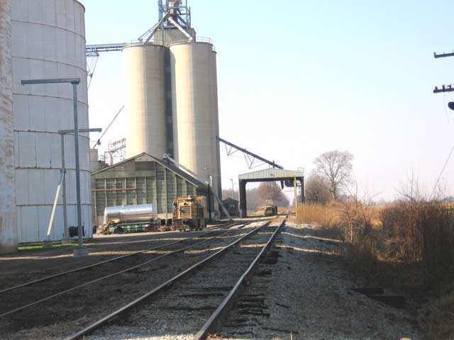
In this photo we are looking West from the same location towards Wilson Road.
There is a lot more of the grain elevator shown in this photo. (Photo: Richard Gehman)
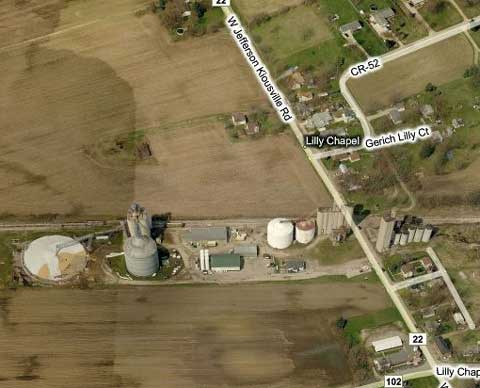
We see here a bird's eye view of the crossing of W. Jefferson-Kiousville
Road and the trail at Lilly Chapel. As you can see the grain elevator
is extensive. (Source: Bing.com)
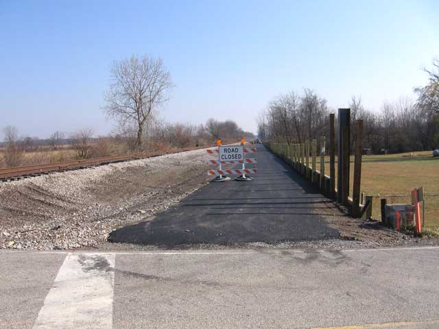
It is 1.92 miles from W. Jefferson Kiousville Road to the trail's crossing of Olmstead Road.
Here you can see the construction from Olmstead Road looking East towards the Alkire
Road crossing and eventually the town of Georgesville. (Photo: Richard Gehman)
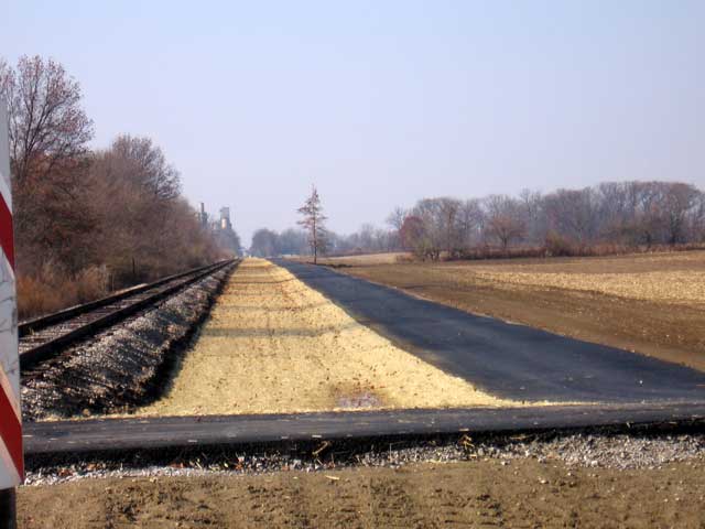
In this photo we are looking West back towards Lilly Chapel. As you can see from the
photo the grain elevator is most definitely a 'local landmark'. (Photo: Richard Gehman)
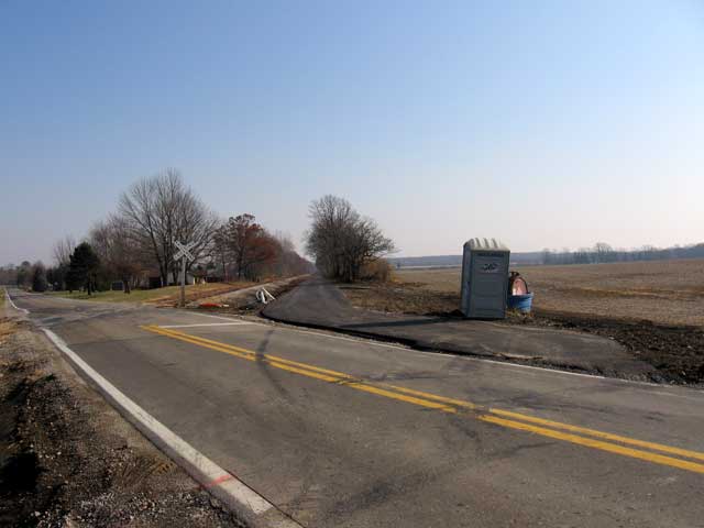
From Olmstead Road to the Alkire Road crossing is about .6 miles. Here we see the Alkire Road
crossing of the trail. We are looking East in this photo towards Georgesville. (Photo: Richard Gehman)
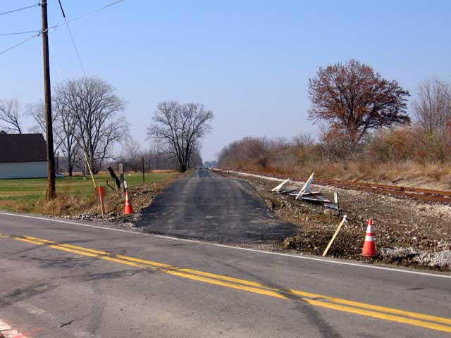
In this photo we are at the same location as above (Alkire Road) looking West back
towards Lilly Chapel. (Photo: Richard Gehman)
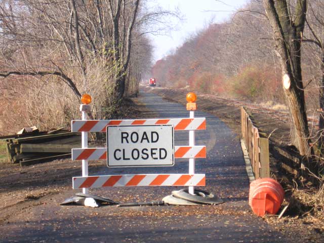
It is 1.1 miles from Alkire Road to the town of Georgesville, Ohio. From this vantage point,
we are looking West back towards Lilly Chapel. What do you see on the track? Yes, it's a
Camp Chase Industrial Railroad train. (Photo: Richard Gehman)
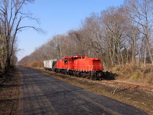
The Camp Chase Railroad Company owns the tracks in this area. While there are not many
trains it is harvest time and according to Richard Gehman, this one was carrying grain from
the elevator in Lilly Chapel towards Columbus.
This trail was originally called the 'Camp Chase RailTrail' because of Camp Chase, which
was a Civil War Prisoner Of War camp in Western Columbus on Sullivant Avenue. Several
Ohio regiments mustered here, boarded the trail and rode West to Xenia where they got
on a Little Miami Railroad train and rode South to Cincinnati, where they were passengers
on a steamer that took them to the South to fight the Civil War. (Photo: Richard Gehman)
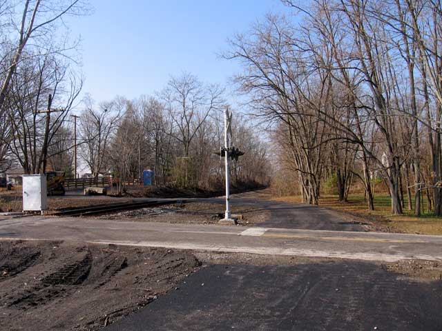
We are now in the town of Georgesville. Here the trail crosses the tracks and goes from
the South side of the tracks to the North side. (Photo: Richard Gehman)
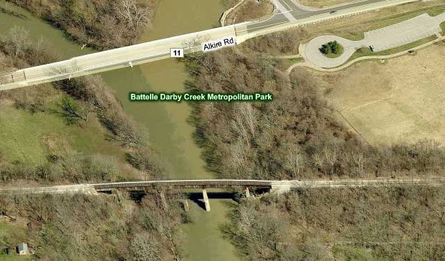
From the town of Georgesville East about .25 miles is the bridge over the Darby Creek. The
road bridge North of the trestle is the Alkire Road crossing, where a 'hanging' pedestrian/bicycle
bridge on the existing bridge has been planned. As you can see at the top right of the photo
is a round feature. It is a parking lot as you can see below. (Photo: Bing.com)
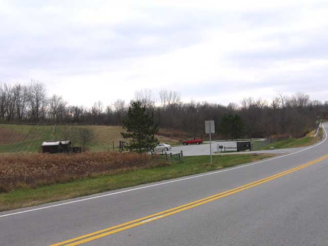
This parking lot for the Battelle Darby Creek Metro Park is at 8465 Alkire Road. The lot
is circular and that's what shows on the Bing.com map above. From here the trail runs
through the park. The bike trail is at the left of the picture (out of sight and not yet built)
near the tree line. There is about a .25 mile gap from the current end of the trail to the
parking lot at Battelle Darby Creek MetroPark. (Photo: Richard Gehman)
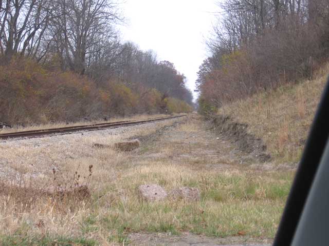
This picture is taken from Darby Creek Drive .90 miles East of the railroad trestle over the
Darby Creek. As you can see construction has started for the trail next to the railroad on
its South side. (Photo: Richard Gehman)
(About Tom Recktenwalt and Miami Valley Rail Trails)

|


